
Stoney Creek, Ontario
Between the lake
and the escarpment.
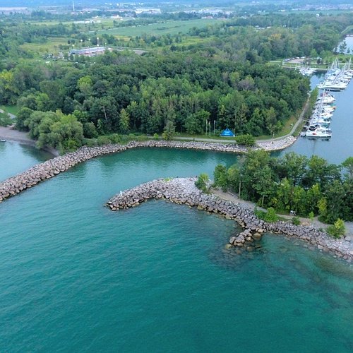
A former city on Hamilton's east side, settled by Loyalists in 1786 and part of Hamilton since 2001. The 1813 battlefield sits in the old town, orchards and vineyards run along the escarpment, and Lake Ontario forms its northern edge.
Emily’s Take
Stoney Creek, between the lake and the Escarpment.
Just east of Hamilton’s core, Stoney Creek sits between Lake Ontario and the Niagara Escarpment, with orchards and wineries to the east and quick QEW access.
Talk to Emily About Stoney Creek“Stoney Creek offers a lot of variety, from waterfront streets to newer family neighbourhoods.”
Emily
The lakefront and the Mountain
Homes range from lakeside streets below the Escarpment to newer subdivisions up on the Mountain in Upper Stoney Creek.
History close by
Battlefield Park marks the 1813 Battle of Stoney Creek, and the old village core still has a small-town feel.
Easy commuting
The QEW and the Red Hill Valley Parkway make trips toward Burlington, Oakville and Niagara straightforward.
A battlefield town
in the fruit belt.
Stoney Creek runs from the Lake Ontario shore up over the Niagara Escarpment on Hamilton's east side, between the lower city and Grimsby in the Niagara Region. Loyalists settled here from 1786; it became a town in 1974, a city in 1984, and part of the City of Hamilton on January 1, 2001.
Stoney Creek — 98.6 km² from lake to Mountain
0
Residents
(2001 Census)
0 km²
Land Area
0
First Loyalist
Settlers
0
Battle of
Stoney Creek
Two Levels
Lower Stoney Creek sits on the lake plain around the old town; Upper Stoney Creek, the Mountain, spreads across the farmland above the escarpment, linked by Centennial Parkway.
Confederation GO
Opened October 27, 2025 near the QEW and Centennial Parkway, with all Lakeshore West trains between Union Station and Niagara Falls stopping there.
Three QEW Exits
Centennial Parkway, Fruitland Road and Fifty Road, with the Red Hill Valley Parkway on the west side connecting to the Lincoln Alexander.
Battlefield House
The Gage family's 1796 farmhouse, where the Battle of Stoney Creek was fought on June 6, 1813. The 100-foot Battlefield Monument beside it was completed in 1913.
The Fruit Belt
Tender fruit and grapes took hold here after the 1880s. E.D. Smith started in Winona in 1882, and the Winona Peach Festival has run since 1967.
Conservation Land
The Devil's Punchbowl, Felker's Falls, Saltfleet and Fifty Point conservation areas, including Fifty Point's 330-boat marina on Lake Ontario.
Population and land area are for the former City of Stoney Creek in the 2001 Census of Population (Statistics Canada), the last census to report it as a separate municipality. It has grown since — Ward 9 (Upper Stoney Creek) grew 25% between the 2016 and 2021 censuses — but is now counted within the City of Hamilton. Settlement year from the Canadian Encyclopedia.
What People Love
A small-town feel
inside a big city.
Ask Stoney Creek residents why they chose it and you'll get roughly these six answers.
The old town, the lakeshore
and the Mountain above.
Stoney Creek splits at the escarpment into the lower town by the lake and Upper Stoney Creek above it, with fruit country running east to Winona. Choose a neighbourhood to see the schools, parks, commute and housing mix that define it.
Lower · Old town core
Where the town began
The original village around King Street, north of Ridge Road and east of Centennial Parkway, with Battlefield House, its park and the monument on the west side. Century homes on the older streets sit among postwar houses and apartment-style condos.
Schools
Collegiate Avenue School, St. John Henry Newman CSS
Parks & Green Space
Battlefield House Museum and Park, Green Acres Park
Getting Around
HSR to Eastgate Square; Confederation GO; QEW at Centennial Pkwy
Walkability
Somewhat walkable
Housing
Century homes, postwar detached and semis, apartment-style condos
Lower · Highway 8 and Dewitt Rd
Detached homes under the escarpment
East of the old town along Highway 8 and Dewitt Road, between the escarpment and the QEW. Almost entirely detached and owner-occupied, from postwar bungalows to larger newer builds near the escarpment.
Schools
St. Francis Xavier CES, Orchard Park SS
Parks & Green Space
Devil's Punchbowl Conservation Area, Bruce Trail
Getting Around
Hwy 8; QEW at Centennial Pkwy or Fruitland Rd
Walkability
Car-dependent
Housing
Mostly detached, postwar bungalows to larger newer homes
North · Lake Ontario
Townhouses by the lake
The strip between the QEW and Lake Ontario, running east to Fifty Point Conservation Area and its marina. Much of it went up after 2000 as condominium townhouses and low-rise condos, with some detached and custom lakefront homes.
Schools
Our Lady of Peace CES, Orchard Park SS
Parks & Green Space
Fifty Point Conservation Area, Waterfront Trail
Getting Around
QEW at Centennial Pkwy, Fruitland Rd and Fifty Rd
Walkability
Car-dependent
Housing
Condo townhouses, low-rise condos, some custom lakefront homes
Lower · East of Dewitt
Orchards giving way to new streets
Long-time fruit-growing land between Dewitt and Winona, now part of the city's Fruitland–Winona Secondary Plan. Older farmhouses and postwar homes along Highway 8 sit beside new subdivision north toward Barton Street.
Schools
Immaculate Heart of Mary CES, Orchard Park SS
Parks & Green Space
Bruce Trail along the escarpment; Fifty Point Conservation Area nearby
Getting Around
QEW at Fruitland Rd; Hwy 8
Walkability
Car-dependent
Housing
Older farmhouses and postwar homes plus new subdivision
Far east · Toward Grimsby
Peach country
The old Winona settlement along Highway 8 and Barton Street at Stoney Creek's eastern edge — home of E.D. Smith since 1882 and the Peach Festival since 1967. Older homes and farm properties south of the QEW, with mostly 2000s-onward subdivision closer to the lake.
Schools
Winona Elementary, St. Gabriel CES
Parks & Green Space
Winona Park, Fifty Point Conservation Area
Getting Around
QEW at Fifty Rd; Hwy 8
Walkability
Car-dependent
Housing
Older homes and farm lots, 2000s-onward detached and townhouses
Upper · Mud St to Rymal Rd
The Mountain's planned suburb
Between Mud Street and Rymal Road, west of Upper Centennial Parkway. Low-rise streets in the interior and townhouses along the edges, with shopping at Mud and Upper Red Hill and at Upper Centennial and Rymal.
Schools
Janet Lee Elementary, Saltfleet District HS
Parks & Green Space
Heritage Green Sports Park, Heritage Green Community Trust Trail
Getting Around
Red Hill Valley Pkwy and the Linc; Upper Centennial Pkwy to the QEW
Walkability
Car-dependent
Housing
Detached homes in the interior, street townhouses on the edges
Upper · Paramount Drive
A community centre at the middle
Upper Stoney Creek's west side along Paramount Drive, near the Eramosa Karst and the Red Hill Valley. Valley Park Community Centre, with its pool, gym and library branch, anchors the neighbourhood.
Schools
Billy Green Elementary, Mount Albion Elementary
Parks & Green Space
Eramosa Karst Conservation Area, Valley Park Community Centre
Getting Around
Mud St; Red Hill Valley Pkwy
Walkability
Car-dependent
Housing
Detached homes and condominium townhouses
Upper · Felker's Falls
A waterfall at the end of the street
Residential streets on the Mountain around Felker's Falls, a 22-metre ribbon waterfall protected by the Hamilton Conservation Authority at the edge of the subdivision. Close to Mud Street and the Red Hill Valley Parkway.
Schools
St. James the Apostle CES, Saltfleet District HS
Parks & Green Space
Felker's Falls Conservation Area, Felker Park
Getting Around
Mud St; Red Hill Valley Pkwy
Walkability
Car-dependent
Housing
Detached homes and townhouses
Upper · Along Rymal Road
Newer townhouses on the south edge
The southern edge of Upper Stoney Creek along Rymal Road East, next to the Glanbrook border. Mostly newer freehold townhouses and detached homes, close to shopping at Upper Centennial and Rymal.
Schools
Bishop Ryan CSS, Shannen Koostachin Elementary
Parks & Green Space
Eramosa Karst Conservation Area, Heritage Green Sports Park
Getting Around
Rymal Rd and Upper Centennial Pkwy; Red Hill Valley Pkwy
Walkability
Car-dependent
Housing
Newer freehold townhouses and detached homes
Upper · Highland Rd and First Rd
Bigger lots east of Upper Centennial
Around Highland Road and First Road, east of Upper Centennial Parkway, near Saltfleet District High School. Mostly detached homes, some on larger lots, with a few townhouse and condo complexes.
Schools
St. Mark CES, Gatestone Elementary
Parks & Green Space
Saltfleet Conservation Area, Heritage Green Sports Park
Getting Around
Upper Centennial Pkwy to the QEW; Mud St
Walkability
Car-dependent
Housing
Mostly detached, some larger lots, a few townhouse complexes
Upper · Rural hamlet
A crossroads on Mud Street
A small hamlet on Mud Street East at Third Road East, surrounded by farmland. A park, a church, a school and a handful of detached homes on rural lots.
Schools
Tapleytown Elementary (relocating into the urban area), Saltfleet District HS
Parks & Green Space
Tapleytown Park, Saltfleet Conservation Area
Getting Around
Mud St; Upper Centennial Pkwy
Walkability
Car-dependent
Housing
Detached homes on rural lots
Upper · Rymal Rd at Swayze Rd
An old crossroads, and a growth debate
A former village at Rymal Road East and Swayze Road where three provincial highways once met; little remains beyond a few homes and a converted church. In August 2026 the Ontario Land Tribunal brought the surrounding Elfrida lands inside Hamilton's urban boundary, and how they will be built out is still before the Tribunal.
Schools
Gatestone Elementary, Saltfleet District HS (nearest)
Parks & Green Space
Saltfleet Conservation Area
Getting Around
Rymal Rd and Upper Centennial Pkwy; Hwy 56 south
Walkability
Car-dependent
Housing
Farmhouses and a few detached homes; future growth area
Neighbourhood names follow common local and MLS usage, and boundaries vary between sources. Schools listed are in or near each area; catchments change — always confirm the catchment for a specific address with the relevant school board.
Fun Facts
Nine things you probably
didn't know about Stoney Creek.
The first Women's Institute, a night battle in 1813, and Canada's only Little League World Series finalist.
On February 19, 1897, about 100 local women met at Squire's Hall and, urged by Adelaide Hoodless, formed the first Women's Institute. Its constitution was written at Erland and Janet Lee's farmhouse, now the Erland Lee Museum.
Shortly after midnight on June 6, 1813, about 700 British troops under Lt.-Col. John Harvey surprised an American army of more than 3,000 camped here. Both American generals, Winder and Chandler, were captured.
The 100-foot Battlefield Monument — a foot for each year since the battle — was unveiled on June 6, 1913 by Queen Mary, remotely from Buckingham Palace.
The Women's Wentworth Historical Society, led by Sara Calder, bought the Gage farmhouse and four acres for $1,900 in 1899 and opened it as a public park that October.
Born in Saltfleet Township in 1794, 19-year-old Billy Green is credited with getting the American password and guiding the British attack. Historians still debate how large his role was.
The Devil's Punchbowl's upper falls drop 33.8 metres, and its gorge walls expose layers of Ordovician and Silurian rock rarely seen in such a large vertical face.
E.D. Smith started making jam from surplus fruit in Winona in 1882. He later sat as an MP and senator, and the company still operates on its original Stoney Creek farm site.
The Winona Peach Festival began in 1967 and has crowned a Peach Queen since its first year — Johanna Van Essen was the first. Each queen delivers a bushel of peaches to Queen's Park.
In 1965 Stoney Creek became the first — and still the only — Canadian team to play in the Little League World Series championship game, losing 3–1 to Windsor Locks, Connecticut.
Sources include the Ontario Heritage Trust, Veterans Affairs Canada, Parks Canada, the Canadian Encyclopedia, the Hamilton Conservation Authority and CBC News. Accounts of Billy Green's role are disputed.