
Brantford, Ontario
A city on the Grand,
where the telephone began.
A city of 104,688 on the Grand River, where Alexander Graham Bell conceived the telephone and Wayne Gretzky learned the game. Here's what living here actually looks like.
Emily’s Take
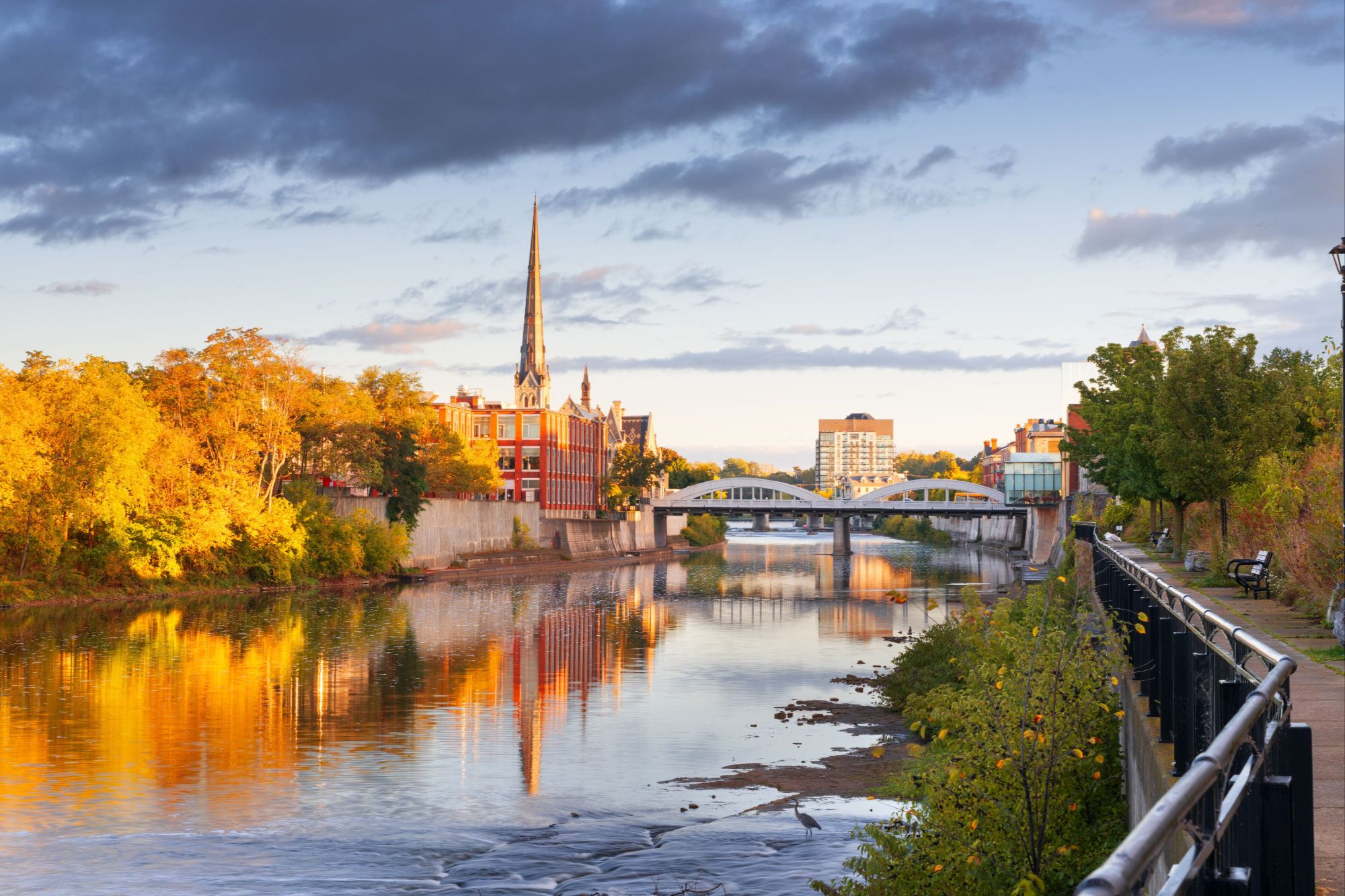
Brantford, on the Grand.
A short drive west along Highway 403, Brantford sits on the Grand River with a historic downtown and a mix of established and newer neighbourhoods.
Talk to Emily About Brantford“Brantford is worth a look for buyers who want more space and a slower pace.”
Emily
Life along the Grand River
Trails and parks follow the river through the city, linking into the Grand River’s wider trail network.
A wide range of homes
From century homes near downtown to newer subdivisions on the edges of the city, there’s a mix of styles and price points.
Connected by the 403
Highway 403 links Brantford with Hamilton, Burlington and Oakville.
A river city
with deep roots.
Brantford sits on the Grand River about 104 km southwest of Toronto, with Hamilton to the east along Highway 403 and Six Nations of the Grand River to the southeast. A single-tier city surrounded by the County of Brant, it was incorporated in 1877 and expanded its boundaries in 2017.
Brantford — 99 km² on the Grand
0
Residents
(2021 Census)
0 km²
Land Area
0
Became a City
0
Median Age
On the Grand
A designated Canadian Heritage River runs through the city, lined by more than 70 km of trails, including the Gordon Glaves loop and the S.C. Johnson Trail to Paris.
Highway 403 and VIA
Highway 403 crosses the city toward Hamilton in one direction and Woodstock in the other, and VIA Rail stops at Brantford station on the Toronto–London corridor.
A University Downtown
Wilfrid Laurier University opened its Brantford campus in 1999 in the restored Carnegie Building, and now occupies heritage buildings across the core.
Brant Conservation Area
A 1.25-acre swimming pool — one of the province's largest — and 336 campsites in a bend of the Grand River, run by the Grand River Conservation Authority.
Glenhyrst Gardens
A sixteen-acre estate on the banks of the Grand River on Ava Road, home to the Glenhyrst Art Gallery of Brant.
Eighteen Neighbourhoods
From the Victorian streets of North Ward and Holmedale to the new subdivisions off Shellard Lane in the southwest.
Population, area and median age from the 2021 Census of Population (Statistics Canada). Land area is 98.65 km² on the boundaries expanded in 2017; on those same boundaries the 2016 count was 98,563. Statistics Canada estimated roughly 111,000 residents in mid-2022. Brantford was incorporated as a city on May 31, 1877.
What People Love
Why people move here
and then stay.
Ask ten Brantford residents why they chose it and you'll get roughly these six answers.
Eighteen neighbourhoods,
and what each one is like.
Brantford runs from Victorian streets along the Grand River to new subdivisions in the southwest. Choose a neighbourhood to see the schools, parks, commute and housing mix that define it.
Central · Colborne St
The core, with a campus in it
Brantford's historic centre along Colborne, Dalhousie and Market streets, where Laurier Brantford now occupies a string of heritage buildings. Mostly rental apartments and lofts, with Harmony Square and the Sanderson Centre steps away.
Schools
Central PS, Brantford Collegiate Institute
Parks & Green Space
Victoria Park, Harmony Square
Getting Around
Brantford Transit and VIA Rail station; Hwy 403 a short drive north
Walkability
Very walkable
Housing
Apartments, lofts and student housing in older commercial blocks
North of downtown · Brant Ave
Victorian streets off Brant Avenue
North of the core around Brant Avenue and the Dufferin district, with some of the city's grandest nineteenth-century homes. Many larger houses have been divided into flats, so the mix leans toward rentals.
Schools
École Dufferin PS, Brantford Collegiate Institute
Parks & Green Space
Jubilee Terrace Park, Preston Park
Getting Around
Walk or bus downtown; Hwy 403 a short drive
Walkability
Very walkable
Housing
Victorian and Edwardian homes, duplex conversions, small apartment buildings
West · Grand River
Riverside streets by the waterworks
West of the core along Grand River Avenue, where the river bends past the city waterworks. Mostly pre-1960 detached homes on quiet streets, with trails and the Rotary Bike Park close by.
Schools
Lansdowne-Costain PS, Christ the King
Parks & Green Space
Rotary Centennial Waterworks Park, Spring Buck Park
Getting Around
Grand River Ave and Brant Ave; Hwy 403 under ten minutes
Walkability
Somewhat walkable
Housing
Pre-1960 detached homes, some apartment buildings
North-central · West St
Established streets below the 403
North of downtown, running up to Highway 403 west of West Street, and one of the city's older residential areas. Character homes on tree-lined streets, with the Wayne Gretzky Sports Centre close by.
Schools
Graham Bell-Victoria PS, Grandview PS
Parks & Green Space
City View Park, Prince Charles Park
Getting Around
West St and North Park St; Hwy 403 at the north edge
Walkability
Somewhat walkable
Housing
Pre-1960 detached homes and small apartment buildings
Northwest · Tollgate Rd
Quiet survey streets near St. John's
The Henderson survey in the northwest, around Paris Road and Tollgate Road. Mostly detached three- and four-bedroom homes, with two high schools nearby and quick Highway 403 access.
Schools
James Hillier PS, St. John's College
Parks & Green Space
Spring Gardens Park
Getting Around
Paris Rd and Tollgate Rd; quick Hwy 403 access
Walkability
Somewhat walkable
Housing
Detached homes, mostly three- and four-bedroom, some small apartments
Northwest · Ava Rd
Large lots by the golf club
Off Ava Road near the Brantford Golf & Country Club, which has played on this site since 1906. Larger detached homes on generous lots, with Glenhyrst Gardens on the river nearby.
Schools
Russell Reid PS, St. John's College
Parks & Green Space
Glenhyrst Gardens, Brant Conservation Area
Getting Around
Paris Rd; Hwy 403 a short drive
Walkability
Car-dependent
Housing
Large detached homes, many four-bedroom-plus, on big lots
North · Woodlawn Ave
Quiet crescents, mostly owner-occupied
A north-end residential pocket built out mainly from the 1960s through the 1990s. Detached homes and townhouses on calm crescents, with a public and a Catholic elementary school close by.
Schools
Russell Reid PS, Our Lady of Providence
Parks & Green Space
Mayfair Park
Getting Around
Woodlawn Ave; Hwy 403 a short drive
Walkability
Car-dependent
Housing
1960s-90s detached homes and townhouses
North end
Family streets near the highway
A north-end neighbourhood built largely in the 1960s and 70s, with groceries within walking distance and some of the quickest Highway 403 access in the city. Almost entirely owner-occupied.
Schools
Greenbrier PS, St. Leo
Parks & Green Space
Greenbrier Park, Cedarland Park
Getting Around
Quick Hwy 403 access
Walkability
Somewhat walkable
Housing
1960s-70s detached homes and townhouses
North · Fairview Dr
Mature lots off Fairview Drive
North Brantford along Fairview Drive, built out mostly in the 1960s and 70s. Single detached homes dominate, with groceries, restaurants and schools within a short walk.
Schools
St. Patrick, École Confédération
Parks & Green Space
Cedarland Park, Tranquility Park
Getting Around
Fairview Dr; Hwy 403 close by
Walkability
Somewhat walkable
Housing
1960s-70s detached homes, mostly two- and three-bedroom
North · Cedarland Dr
Mature trees north of the 403
North of Highway 403 around Cedarland Drive, with most homes dating from the 1960s and 70s. Detached houses on mature lots plus several apartment buildings, and a quick run to the highway via Wayne Gretzky Parkway.
Schools
Brier Park PS, Resurrection
Parks & Green Space
Brier Park, Cedarland Park
Getting Around
Wayne Gretzky Pkwy to Hwy 403
Walkability
Car-dependent
Housing
1960s-70s detached homes and apartment buildings
North-central · West St
Close to the Gretzky Centre
North-central Brantford off West Street, near North Park Collegiate and the Wayne Gretzky Sports Centre. Mostly 1960s and 70s detached homes, with apartment buildings mixed in.
Schools
Centennial-Grand Woodlands School, North Park CVS
Parks & Green Space
Grandwoodlands Park, Wayne Gretzky Sports Centre
Getting Around
West St; Hwy 403 a short drive
Walkability
Somewhat walkable
Housing
1960s-70s detached homes and apartment buildings
Northeast · Brantwood Park Rd
Two schools and a community centre
Northeast Brantford around Brantwood Park Road, where the Branlyn Community Centre shares a site with public and Catholic elementary schools. Mostly detached homes and townhouses, many from the 1980s.
Schools
Branlyn Community School, Notre Dame
Parks & Green Space
Branlyn Community Centre
Getting Around
Brantwood Park Rd and Banbury Rd; car-oriented
Walkability
Car-dependent
Housing
1980s detached homes and townhouses
Northeast
1980s family streets
A northeast subdivision built mainly in the 1980s, with horse-themed street names like Palomino Drive and Ponytrail Drive. Detached homes and townhouses, mostly owner-occupied, with an elementary school close by.
Schools
Banbury Heights School
Parks & Green Space
Lynden Hills Park
Getting Around
Hwy 403 a short drive; car needed for errands
Walkability
Car-dependent
Housing
1980s detached homes and townhouses
East of downtown · Rawdon St
Walk downtown, with a new park
Just east of the core along Rawdon, Park and Marlborough streets. Mostly pre-1960 detached homes and duplexes, with the 17-acre Arrowdale Community Park opened in 2026.
Schools
King George ES, Holy Cross
Parks & Green Space
Arrowdale Community Park, Recreation Park
Getting Around
Brantford Transit routes; walk to downtown
Walkability
Very walkable
Housing
Pre-1960 detached homes, duplexes, small apartment buildings
East · Colborne St E
The old village on the east side
Once a separate village, Echo Place joined Brantford in 1955 and stretches east along Colborne Street. Detached homes from the 1960s and 70s alongside older houses and some 2000s infill.
Schools
Echo Place ES, St. Peter
Parks & Green Space
Woodman Park Community Centre, Kiwanis Field
Getting Around
Colborne St E and Park Rd N; easy highway access
Walkability
Car-dependent
Housing
1960s-70s detached homes, older houses, small apartment buildings
South of the river · Erie Ave
Numbered avenues by Mohawk Park
South of the Grand River along Erie Avenue, and one of the city's most historic neighbourhoods. Pre-1960 detached homes on the numbered avenues, with Mohawk Park and the Woodland Cultural Centre nearby.
Schools
Bellview PS, Madonna Della Libera
Parks & Green Space
Tutela Park splash pad, Mohawk Park
Getting Around
Erie Ave; short drive to downtown
Walkability
Somewhat walkable
Housing
Pre-1960 detached homes, updated older houses, some infill
Southwest · Gilkison St
River flats and sports fields
Across the river southwest of downtown, from older streets near Gilkison Flats out to newer subdivisions toward Shellard Lane. Roughly half detached homes, plus apartment buildings and the Lions Park arena.
Schools
Agnes G. Hodge PS, St. Gabriel
Parks & Green Space
Dogford Park, D'Aubigny Creek trails
Getting Around
Mount Pleasant St and Gilkison St; Hwy 403 a short drive
Walkability
Somewhat walkable
Housing
Older detached homes, apartment buildings, newer subdivisions
Southwest · Shellard Ln
Brantford's newest subdivisions
The southwest growth area around Shellard Lane, mostly built after 2000. Detached homes and townhouses on family-sized lots, with new schools and a 24-acre community park scheduled to open in 2026.
Schools
Walter Gretzky ES, Assumption College
Parks & Green Space
Southwest community park (2026), CN Rail Trail
Getting Around
Shellard Ln; Hwy 403 a short drive
Walkability
Car-dependent
Housing
Post-2000 detached homes and townhouses
Neighbourhood boundaries vary between sources, and school catchments change — always confirm the catchment for a specific address with the relevant school board.
Fun Facts
Nine things you probably
didn't know about Brantford.
A river crossing, the first long-distance call, and The Great One's backyard rink.
The city takes its name from Brant's Ford, the Grand River crossing near Mohawk leader Joseph Brant's village, settled after the Crown granted the valley to the Six Nations in 1784.
His Majesty's Royal Chapel of the Mohawks was built in 1785. King Edward VII made it a Chapel Royal in 1904, and it was named a National Historic Site in 1981.
Thayendanegea — Joseph Brant — died in 1807 at his home at the head of Lake Ontario. In 1850 his remains were moved to a tomb beside the Mohawk Chapel, where his son John is also interred.
Alexander Graham Bell worked out the principle of the telephone on July 26, 1874, at his parents' home — now the Bell Homestead National Historic Site.
On August 10, 1876, Bell made the first successful long-distance telephone call, between Brantford and Paris, Ontario.
The Carnegie Building, built as Brantford's public library in 1902–04, became Wilfrid Laurier University's first Brantford building in 1999.
Wayne Gretzky was born in Brantford on January 26, 1961. His father Walter flooded a rink behind the family home on Varadi Avenue — the “Wally Coliseum.”
E. Pauline Johnson (Tekahionwake) was born at Chiefswood on Six Nations, southeast of the city, on March 10, 1861, and graduated from Brantford Central Collegiate in 1877.
James G. Cockshutt founded the Brantford Plow Works in 1877. As the Cockshutt Plow Company it built farm equipment here until White Motor ended Brantford production in 1962.
Sources include the Canadian Encyclopedia, the City of Brantford and the Bell Homestead, Wilfrid Laurier University, Parks Canada and Statistics Canada.