
Binbrook, Ontario
A village by the lake,
with country all around.
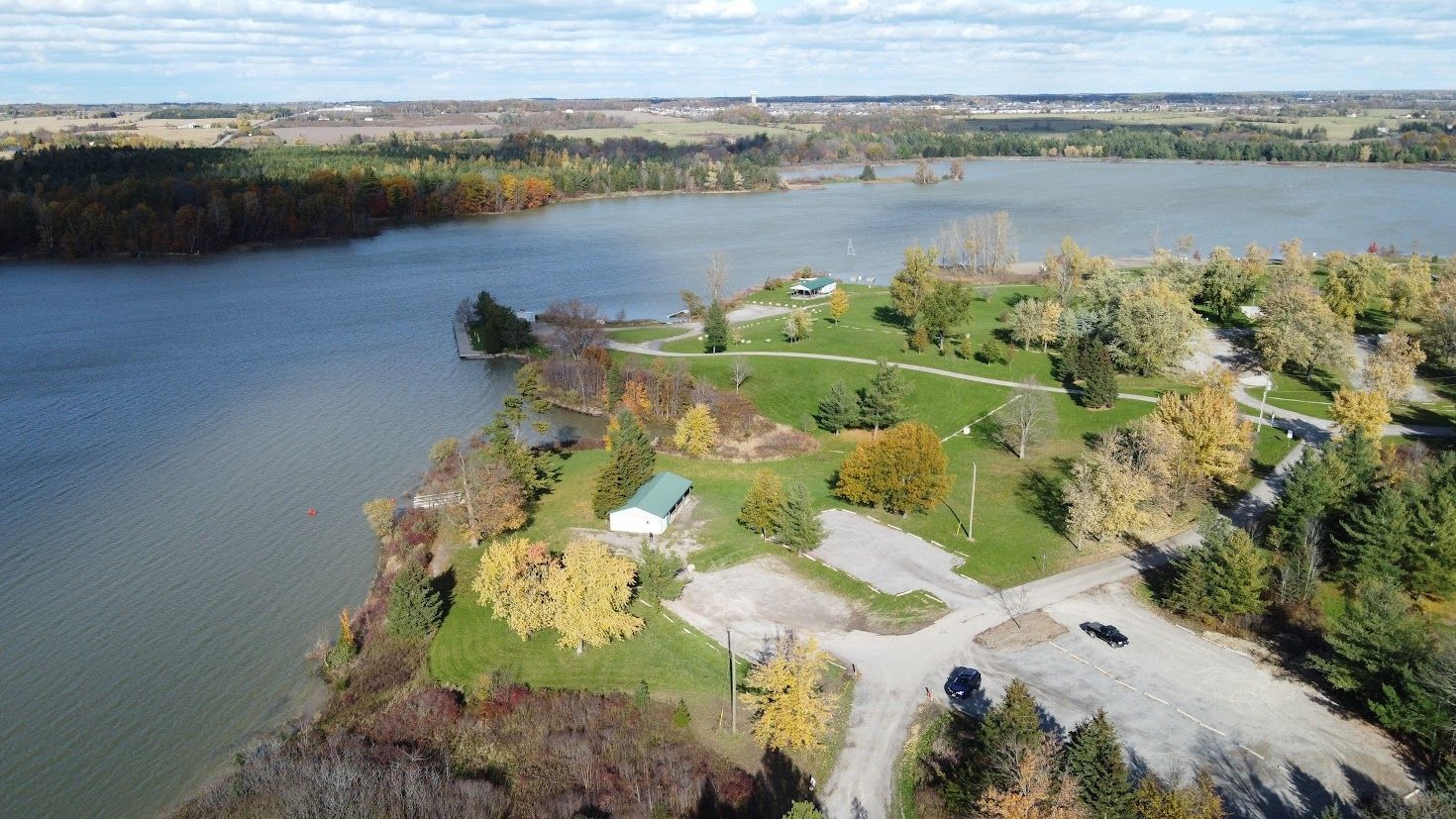
A growing village in Hamilton's rural southeast, in the former Township of Glanbrook — with Lake Niapenco close by, farmland on every side, and a fall fair first held in 1854.
Emily’s Take
Binbrook, small-town and growing.
South of Hamilton in Glanbrook, Binbrook pairs a small-town feel with newer family neighbourhoods.
Talk to Emily About Binbrook“Binbrook is a great option for families looking for a quieter pace.”
Emily
Newer family homes
Much of Binbrook’s housing is newer, with family-sized homes and townhomes close to parks and schools.
Nature on the doorstep
Binbrook Conservation Area and Lake Niapenco offer trails, swimming and paddling close to home.
Room to breathe
Surrounded by farmland, Binbrook suits buyers who want more space while keeping Hamilton within easy reach.
A small village
that keeps on growing.
Binbrook sits in the former Township of Glanbrook, in the City of Hamilton’s rural southeast, south of the Hamilton Mountain along Highway 56. The township was surveyed in the 1790s; the village grew up around its crossroads and fairgrounds, near the headwaters of the Welland River.
Binbrook — Hamilton’s rural southeast
0
Residents
(2021 Census)
0%
Population Growth
2016–2021
0 km²
Built-Up Area
0
First Binbrook Fair
Lake Niapenco
Created by a 1971 dam near the source of the Welland River, it is the largest inland lake in the Niagara watershed.
Highway 56
The village’s main road and its route north to Rymal Road and the Hamilton Mountain, with the Linc and Red Hill Valley Parkway beyond.
The Fairgrounds
The Agricultural Society’s grounds on Highway 56 host the September fair, with Fairgrounds Community Park and its splash pad on Fall Fair Way.
The Airport Next Door
John C. Munro Hamilton International Airport and the Canadian Warplane Heritage Museum are both in Mount Hope, also in Glanbrook.
New Schools
Our Lady of Hope opened in 2021, and the public board is planning a new 615-student elementary school for Binbrook.
Part of Hamilton
Binbrook and Glanford townships merged as Glanbrook in 1974, and Glanbrook joined the amalgamated City of Hamilton in 2001.
Population, growth and land area are for the Statistics Canada “Binbrook” population centre in the 2021 Census of Population, which covers the built-up village only (8,794 residents in 2016). The surrounding rural area is counted within the City of Hamilton.
What People Love
Why people move here
and then stay.
Ask Binbrook residents why they chose it and you’ll hear roughly these six answers.
Eight areas,
and what each one is like.
Binbrook is one village rather than a patchwork of named neighbourhoods, so these are the areas buyers usually weigh — the village itself and the Glanbrook countryside around it. Choose one to see the schools, parks, commute and housing mix.
Historic core · Hwy 56 & Binbrook Rd
Where the village started
The crossroads of Highway 56 and Binbrook Road, which the City’s secondary plan designates as the community core — shops, services, churches, the Agricultural Hall and Binbrook Park within a few blocks.
Schools
Bellmoore ES, Our Lady of Hope CES, Saltfleet DHS
Parks & Green Space
Binbrook Park, Glanbrook Sports Complex
Getting Around
Highway 56 north to Rymal Road; car-dependent
Walkability
The most walkable part of Binbrook
Housing
Older village homes and bungalows alongside newer towns
Central · Around the fairgrounds
Next door to the fair
The newer streets around the Agricultural Society fairgrounds and Fall Fair Way, the by-pass road linking Highway 56 to Binbrook Road. Fairgrounds Community Park has a playground, shelter and splash pad.
Schools
Bellmoore ES, St. Matthew CES, Bishop Ryan CSS
Parks & Green Space
Fairgrounds Community Park, Binbrook fairgrounds
Getting Around
Fall Fair Way to Highway 56 and Binbrook Road
Walkability
Car-dependent; walk to the park and fairgrounds
Housing
Newer detached, semis and condominium townhomes
West · Toward Fletcher Road
Where the next phase is going
The western side of the village toward Fletcher Road, the secondary plan’s western boundary. New development planned south of Binbrook Road includes detached, semi-detached, townhomes and parkland.
Schools
Bellmoore ES, Our Lady of Hope CES
Parks & Green Space
New parkland planned with the development
Getting Around
Binbrook Road east to Highway 56
Walkability
Car-dependent
Housing
Planned detached, semis, towns and medium density
East of Highway 56 · Adult lifestyle
Quieter streets east of the highway
East of Highway 56 and north of Binbrook Road, where the secondary plan sets aside lands for adult lifestyle developments, a short drive from the village core.
Schools
École élémentaire Michaëlle Jean (French Immersion), Saltfleet DHS
Parks & Green Space
Binbrook Park, Glanbrook Sports Complex
Getting Around
Highway 56 north to Rymal Road
Walkability
Car-dependent
Housing
Adult lifestyle communities and detached homes
Village edge · Conservation lands
Beside the lake
The rural roads just outside the village around Binbrook Conservation Area and Lake Niapenco, the largest inland lake in the Niagara watershed, owned and run by the Niagara Peninsula Conservation Authority.
Schools
Bussed to Binbrook schools
Parks & Green Space
Binbrook Conservation Area — beach, splash pad, trails
Getting Around
Harrison Road to Highway 56; no local transit
Walkability
Car-dependent
Housing
Rural homes, farmhouses and larger lots
Rural settlement · Glanbrook
A hamlet in the farmland
A small rural settlement area at Woodburn Road and Golf Club Road, a short drive from Binbrook — farmland, country roads and the historic Christ Church Woodburn.
Schools
Bussed to Glanbrook-area schools
Parks & Green Space
Open farmland; Binbrook Conservation Area a short drive away
Getting Around
No local transit; country roads to Highway 56
Walkability
Car-dependent
Housing
Rural homes, farms and acreages
West Glanbrook · Highway 6
The airport village
Binbrook’s western neighbour in Glanbrook, a village of about 2,400 people beside John C. Munro Hamilton International Airport and the Canadian Warplane Heritage Museum.
Schools
Mount Hope Elementary (HWDSB)
Parks & Green Space
Mount Hope Park, Canadian Warplane Heritage Museum nearby
Getting Around
Highway 6 north to the Linc and Highway 403
Walkability
Car-dependent
Housing
Village homes, bungalows and rural lots
Countryside · Former township
Farms between the villages
The farmland and hamlets of the former Township of Glanbrook around Binbrook, including Blackheath and Tyneside, with Southbrook Golf & Country Club among the fields.
Schools
Bussed — confirm the catchment by address
Parks & Green Space
Southbrook Golf & Country Club, Binbrook Conservation Area
Getting Around
No local transit; Highways 56 and 6
Walkability
Car-dependent
Housing
Farmhouses, acreages and country homes
Neighbourhood boundaries vary between sources, and school catchments change — always confirm the catchment for a specific address with the Hamilton-Wentworth District School Board or Hamilton-Wentworth Catholic District School Board.
Fun Facts
Nine things you probably
didn't know about Binbrook.
An English namesake, a fair older than Confederation, and a river that runs backwards.
The township took its name from Binbrook in Lincolnshire, England. First registered as Township No. 11 in 1791, it was renamed Binbrook in 1792 and placed in Wentworth County when that county was created in 1816.
The Binbrook Agricultural Society was founded in 1854 and held its first fair that year. The 165th fair ran in September 2019, and the volunteer society still runs it every fall.
A dam near the source of the Welland River has held back Lake Niapenco since 1971, controlling flooding downstream. The conservation authority calls it the largest inland lake in the Niagara watershed.
Glanbrook was created in 1974 by joining the townships of Glanford and Binbrook into one municipality of the new Regional Municipality of Hamilton–Wentworth.
On January 1, 2001, Glanbrook was amalgamated with Hamilton, Stoney Creek, Ancaster, Dundas and Flamborough to form the present City of Hamilton.
George Washington Johnson, born in Binbrook Township in 1839, wrote “When You and I Were Young, Maggie” for Maggie Clark before they married in 1864. Set to music in 1866, it is marked by a provincial plaque at the Glanbrook Municipal Centre.
Hamilton’s airport in Mount Hope opened in 1940 as an RCAF airfield for the British Commonwealth Air Training Plan. It went civilian in 1963 and was renamed for John C. Munro in 1998.
The Canadian Warplane Heritage Museum, next door in Mount Hope, keeps the Mynarski Memorial Lancaster — one of only two airworthy Lancaster bombers left in the world.
The Welland River rises near Binbrook and flows to the Niagara River. Near its mouth, the Niagara River’s control dam makes it reverse direction twice a day, as far upstream as Wellandport.
Sources include the Binbrook Agricultural Society, the Niagara Peninsula Conservation Authority, the Ontario Heritage Trust, the City of Hamilton, the Canadian Warplane Heritage Museum and Statistics Canada. Early township dates vary between sources.